Charles County, Maryland
| Charles County, Maryland | ||
|
||
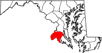 Location in the state of Maryland |
||
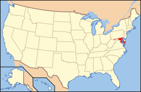 Maryland's location in the U.S. |
||
| Founded | 1658 | |
|---|---|---|
| Seat | La Plata | |
| Area - Total - Land - Water |
643 sq mi (1,665 km²) 461 sq mi (1,194 km²) 182 sq mi (471 km²), 28.33% |
|
| PopulationEst. - (2007) - Density |
140,444 303/sq mi (117/km²) |
|
| Website | www.charlescounty.org | |
Charles County is a county in the south central portion of the U.S. state of Maryland.
As of 2000, the population was 120,546. Its county seat is La Plata. This county was named for Charles Calvert (1637–1715), third Baron Baltimore.
Charles County is a part of the Washington Metropolitan Area.
Contents |
History
Charles County was created in 1658 by an Order in Council. There was an earlier Charles County from 1650 to 1653, sometimes referred to in historic documents as Old Charles County.[1][2][3]
In April 1865, John Wilkes Booth made his escape through Charles County after shooting President Abraham Lincoln. He was on his way to Virginia.
On April 28, 2002, a tornado cut through the County and destroyed much of downtown La Plata.
The county has a number of properties on the National Register of Historic Places.[4]
Law and Government
Charles County is reliably Democratic, although not as overwhelmingly so as other parts of Maryland's Washington, D.C. suburbs.
Board of Commissioners
Charles County is governed by county commissioners, the traditional form of county government in Maryland. There are five commissioners. As of 2008[update], they are:
| Position | Name | Affiliation | District | |
|---|---|---|---|---|
| President | Wayne Cooper | Democratic | At-Large | |
| Commissioner | Sam Graves | Democratic | District 1 | |
| Commissioner | Edith J. Patterson | Democratic | District 2 | |
| Commissioner | Reuben B. Collins, II | Democratic | District 3 | |
| Commissioner | Gary V. Hodge | Democratic | District 4 | |
Charles County is entirely located within the 5th Congressional District. The current representative is Democratic House Majority Leader Steny H. Hoyer.
Geography
According to the U.S. Census Bureau, the county has a total area of 643 square miles (1,666 km²), of which 461 square miles (1,194 km²) is land and 182 square miles (472 km²) (28.33%) is water.
In its western wing, along the southernmost bend in Maryland Route 224, Charles County contains a rare instance where the traveler is due north, east, south, and west of the same state—Virginia.[5]
Adjacent counties
- Prince George's County (north)
- Fairfax County, Virginia (northwest)
- Calvert County (east)
- Stafford County, Virginia (west)
- Prince William County, Virginia (west)
- St. Mary's County (southeast)
- Westmoreland County, Virginia (southeast)
- King George County, Virginia (south)
See also: List of counties bordering eight counties
National protected area
- Thomas Stone National Historic Site
Transportation
One United States Numbered Highway runs through the county U.S. Route 301, some other notable highways are:
- Maryland Route 5
- Maryland Route 6
- Maryland Route 210
- Maryland Route 224
- Maryland Route 228
- Maryland Route 925
Hunters Brooke Arson
On December 4, 2004 an arson took place in the development of Hunters Brooke which is located a few miles southeast of Indian Head. It later became the largest residential arson[6] in the history of the state of Maryland.[7][8][9]
Demographics
The county is experiencing a dramatic growth in African-American population, which began in 1990. Census figures below are from 2000:
As of the census[10] of 2000, there were 120,546 people, 41,668 households, and 32,292 families residing in the county. The population density was 262 people per square mile (101/km²). There were 43,903 housing units at an average density of 95 per square mile (37/km²). The racial makeup of the county was 68.51% White, 26.06% Black or African American, 0.75% Native American, 1.82% Asian, 0.06% Pacific Islander, 0.72% from other races, and 2.08% from two or more races. 2.26% of the population were Hispanic or Latino of any race. 11.6% were of German, 10.8% Irish, 10.2% English, 9.3% American and 5.3% Italian ancestry according to Census 2000.
There were 41,668 households out of which 41.10% had children under the age of 18 living with them, 58.00% were married couples living together, 14.50% had a female householder with no husband present, and 22.50% were non-families. 17.20% of all households were made up of individuals and 5.20% had someone living alone who was 65 years of age or older. The average household size was 2.86 and the average family size was 3.21.
In the county the population was spread out with 28.70% under the age of 18, 7.60% from 18 to 24, 33.20% from 25 to 44, 22.70% from 45 to 64, and 7.80% who were 65 years of age or older. The median age was 35 years. For every 100 females there were 95.50 males. For every 100 females age 18 and over, there were 92.20 males.
The median income for a household in the county was $62,199, and the median income for a family was $67,602 (these figures had risen to $80,573 and $89,358 respectively as of a 2007 estimate[11]). Males had a median income of $43,371 versus $34,231 for females. The per capita income for the county was $24,285. About 3.70% of families and 5.50% of the population were below the poverty line, including 6.70% of those under age 18 and 8.60% of those age 65 or over.
Cities and towns
This county contains the following incorporated municipalities:
- Indian Head (incorporated 1920)
- La Plata (incorporated 1888)
- Port Tobacco Village (incorporated 1888) (Note that, despite its name, Port Tobacco Village is a town, not a village.)
All three are classified as towns under Maryland law. About half the County population lives around the large unincorporated community of Waldorf, Maryland.
Unincorporated areas are also considered as towns by many people and listed in many collections of towns, but they lack local government. Various organizations, such as the United States Census Bureau, the United States Postal Service, and local chambers of commerce, define the communities they wish to recognize differently, and since they are not incorporated, their boundaries have no official status outside the organizations in question. The Census Bureau recognizes the following census-designated places in the county:
- Bennsville
- Bryans Road
- Hughesville
- Potomac Heights
- Saint Charles
- Waldorf
Other unincorporated places not listed as Census-Designated Places but known in the area include:
- Bel Alton
- Benedict
- Bryantown
- Cobb Island
- Dentsville
- Faulkner
- Grayton
- Ironsides
- Issue
- Malcolm
- Marbury
- Morgantown
- Mount Victoria
- Nanjemoy
- Newburg
- Pisgah
- Pomfret
- Popes Creek
- Pomonkey
- Ripley
- Rison
- Rock Point
- Swan Point
- Welcome
- White Plains
Education
Colleges and universities
- College of Southern Maryland, in La Plata.
Public school system
Notable residents
- Jane Herbert Wilkinson Long (1798–1880) is considered to be the “Mother of Texas.”
- Benjamin Stoddert (1751–1813), first United States Secretary of the Navy
- Samuel Alexander Mudd (1833–1883)- Born in Charles County, Mudd is the Maryland doctor implicated and imprisoned for aiding John Wilkes Booth in the assassination of President Abraham Lincoln.
- George Cary (1811–1850), born near Allens Fresh in Charles County, United States Congressman from Georgia[12]
- James Neale (1615–1684) Born Drury Lane, London, England immigrated 1634, founded Wollaston Manor plantation and Cobb Island.
- Prominent Revolutionary War statesmen John Hanson, Thomas Stone, Daniel of St. Thomas Jenifer, and General William Smallwood
- Barnes Compton, US Congressman
- James Craik Physician General during the American Revolution, and Gustavus Richard Brown were George Washington's physicians.
- Josiah Henson (1789–1883) former slave and author.
- Co-discoverer of the North Pole Matthew Henson (African-American) and Captain Raphael Semmes of the Confederate ship "Alabama" were born near Nanjemoy.
- Chuck Brown, hip-hop musician, lives in Waldorf
- Christina Milian, musician, lived in Waldorf
- Joel and Benji Madden from the band Good Charlotte grew up in Waldorf
- Robert Stethem, noted terror hijacking victim, grew up in Pinefield, Waldorf
- Danny Gatton (1945–1994), legendary guitarist, lived in Newburg
- Larry Johnson, running back for the Washington Redskins is from Pomfret, Maryland.
- Randy Starks, defensive tackle for the Miami Dolphins is from Waldorf.
Sports
| Club | League | Venue | Established | Championships |
|---|---|---|---|---|
| Southern Maryland Blue Crabs | ALPB, Baseball | Regency Furniture Stadium | 2008 | 0 |
References
- ↑ The Counties of Maryland. 630. The Archives of Maryland Online. pp. 122–124. http://www.msa.md.gov/megafile/msa/speccol/sc2900/sc2908/000001/000630/html/am630--122.html. Retrieved November 16, 2007
- ↑ Maryland Geological Survey (1911). Prince Georges County. The Johns Hopkins Press. pp. 21–22. http://books.google.com/?id=l9xLAAAAMAAJ&pg=PA22&lpg=PA22&dq=%22old+charles+county%22. Retrieved November 16, 2007
- ↑ Maryland Geological Survey (1906). Maryland Geological Survey: General Reports. The Johns Hopkins Press. pp. 474–477. http://books.google.com/?id=yBIMAAAAYAAJ&pg=RA1-PA474&lpg=RA1-PA474&dq=%22history+of+charles+county%22. Retrieved April 5, 2008
- ↑ "National Register Information System". National Register of Historic Places. National Park Service. April 15, 2008. http://www.nr.nps.gov/.
- ↑ This oddity of political geography happens in other places in Maryland, the sole state with points where travel as the crow flies due north, east, south, and west goes into the same state (Virginia).
- ↑ United States Attorney for the District of Maryland (March 1, 2006). "Violent Crime Program 2005 Annual Report". United States Department of Justice. http://www.justice.gov/usao/md/Exile/files/Annual%20Report%202005%20Violent%20Crime%20Program.pdf. Retrieved August 2, 2010.
- ↑ Courson, Paul; Joanthan Wild. "Two more arrested in Maryland fires" (in ENGLISH). Washington, Dc: CNN. p. 1. http://www.cnn.com/2004/LAW/12/21/maryland.fires/index.html. Retrieved August 2, 2010.
- ↑ Witte, Brian (January 3, 2005). "Maryland Hunts for Motives Behind State's Largest Residential Arson" (in English). Insurance Journal. http://www.insurancejournal.com/magazines/east/2005/01/03/features/50855.htm. Retrieved August 2, 2010.
- ↑ Hancock, David (Dec. 18, 2004). "3 More Charged In Maryland Arson" (in ENGLISH). LA PLATA, Md: CBS NEWS. p. 1. http://www.cbsnews.com/stories/2004/12/06/national/main659400.shtml. Retrieved August 2, 2010.
- ↑ "American FactFinder". United States Census Bureau. http://factfinder.census.gov. Retrieved 2008-01-31.
- ↑ http://factfinder.census.gov/servlet/ACSSAFFFacts?_event=ChangeGeoContext&geo_id=05000US24017&_geoContext=01000US%7C04000US24%7C05000US24013&_street=&_county=charles&_cityTown=charles&_state=04000US24&_zip=&_lang=en&_sse=on&ActiveGeoDiv=geoSelect&_useEV=&pctxt=fph&pgsl=010&_submenuId=factsheet_1&ds_name=ACS_2007_3YR_SAFF&_ci_nbr=null&qr_name=null®=null%3Anull&_keyword=&_industry=
- ↑ Who Was Who in America, Historical Volume, 1607–1896. Chicago: Marquis Who's Who. 1963
External links
 |
Fairfax County, Virginia | Prince George's County | |
|
| Stafford County, Virginia and Prince William County, Virginia | Calvert County | |||
| King George County, Virginia | St. Mary's County and Westmoreland County, Virginia |
|
|||||||||||||||||
|
|||||||||||||||||||||||